Q: What does the South Padre Bay Cam show?
A:The South Padre Bay Cam™ provides a live view of the Laguna Madre bay side of South Padre Island, showing water conditions, boat activity, wildlife, weather, and the famous Texas coast sunsets.
Q: What are the best surf conditions on South Padre Island?
A: The best surf on South Padre Island comes from north and northeast swells, typically in fall and winter when fronts push through. Wave heights commonly range from 2–6 feet, with bigger sets during tropical systems.
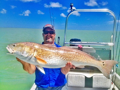
Q: Why is the Laguna Madre important for fishing?
A: The Laguna Madre is a hypersaline lagoon famous for world-class shallow-water flats fishing, particularly for speckled trout, redfish, and flounder in crystal-clear, gin-flat conditions.
Q: Can I see dolphins from the bay cam?
A: Yes, bottlenose dolphins are frequently visible in the Laguna Madre from the bay cam, especially in the early morning and late afternoon when they are most active near the surface.
Q: Is the Laguna Madre good for kiteboarding?
A: The Laguna Madre is considered one of the top kiteboarding destinations in the United States due to its shallow depth, warm water, and steady South Texas winds — ideal for learning and advanced riding.
Q: What time are the best sunsets viewed from South Padre Island?
A: Sunsets over the Laguna Madre are spectacular year-round. The best viewing times are 30–60 minutes before official sunset, and the bay cam archives highlight memorable sunsets from the island.
South Padre Island Fishing Reports, Fishing Guides and Links
Local Fishing Guides - South Padre Island and Port Isabel area fishing guides for the Laguna Madre and offshore.
Texas Parks and Wildlife - Welcome to Texas Parks and Wildlife Department Web site, your online connection to some of the fi
nest outdoor recreation in the world, including hunting, fishing, camping, hiking, biking, birdwatching and much more. You will also find the latest on TPWD's efforts to conserve fish and wildlife species and habitat as well as cultural and historic sites across Texas, with many opportunities for you to get involved with this important work.
Hunting - Recreational hunting and fishing licenses and stamp endorsements are available at approximately 2,000 locations throughout the state in addition to TPWD offices and parks. These locations include sporting goods stores, gun shops, department stores, discount stores, bait and tackle shops, grocery stores, and many other types of stores. Some commercial hunting and fishing licenses are available ONLY at the Austin Headquarters and Law Enforcement Offices. For added convenience, licenses may be purchased by phone or through the Internet with approved Visa, Discover, or MasterCard. A $5 administrative fee will be charged for those sales. Many licenses may be purchased for immediate use except where tagging is required, i.e., deer and turkey. For general license questions, please call TPWD Headquarters in Austin at (800) 792-1112 or (512) 389-4800. Staff is available to help answer questions Monday through Friday, 8:00 a.m. to 5:00 p.m, Central Standard Time.
TP&W Fishing Report - Texas Parks and Wildlife weekly fishing report for the entire Texas coastal bay system.
Texas International Fishing Tournament - For more than 70 years the Texas International Fishing Tournament has taken pride in creating an atmosphere of friendly fishing competition and wholesome family fun. The 70th annual five day event, scheduled for July 29 - August 2, 2009, offers fishing divisions that include bay, offshore and tarpon. TIFT is open to anglers of all ages and is the largest saltwater fishing tournament in Texas.
Coastal Conservation Association Texas - CCA is Saltwater Conservation - Marine Fisheries Advocacy - Funding Research, Hatcheries, Coastal Enforcement, and Marine Fisheries Education - Fighting For Quality and Quantity of Freshwater Inflows for Coastal Bays and Estuaries - Providing Millions of Dollars in College Scholarships through the STAR Tournament
Sport Fishing Magazine - Welcome to Sport Fishing Magazine, your online resource for sportfishing boats and equipment reviews, techniques, fishing vacation info, and inspiration to empower the ultimate saltwater sportstman.
Coastal Marine Forecast - Coastal waters forecast from the National Weather Service Office Brownsville Texas for the lower Texas coastal waters from Baffin Bay to the mouth of the Rio Grande out to 20 nautical miles.
Ladies Kingfish Tournament - South Padre Island Chamber of Commerce annual fishing tournament. Anglers fishing in the Bay Division will vie for trophies in the categories of redfish, trout, flounder and snook, while anglers in the Offshore Division compete in the categories of kingfish, bonito, blackfin tuna and dolphin. In addition to trophies being awarded to the first three places in each category; grand champion bay and grand champion offshore winners will also receive trophies.
Local Weather - South Padre Island Texas Live Weather Web Cams, weather video and forecast page on Spadre.com.
Check current Island weather conditions, information and forecast, hurricane advisories and tropical weather, local radar, National Data
Buoy Center offshore buoys, marine weather, tides, NOAA and NWS links, wave models, water temperature and more.
Check the Live Beach, Bay and Surf Cams for current live weather conditions.
Shark Fishing - Welcome to TEXAS SHARK FISHING! We are one of the most active shark fishing sites in the world. Our site features videos, thousands of photos, weekly reports, shark fishing information, and much more. If you are interested in the sport or an experienced shark fisherman, this is a great place to call home.
Texas Clipper - The Texas Clipper is a multilevel dive, meaning experienced, open-water certified divers can explore the sun deck, navigation deck and the promenade at 65 to 70 feet. Penetration divers, experienced with overhead environments, can tackle interior spaces. Meanwhile, because much of the wreck is more than 70 feet above the bottom The Texas Clipper can be compared to a large museum, requiring scuba divers to make several trips to fully appreciate it because of the size. "The ship is so large you can dive a hundred times and still not see everything," Captain O’Leary of American Diving offers guided dive trips.
Saltwater Sportsman Magazine - SaltWaterSportsman.com is the online portal for one of the world's leading sport fishing magazines and features streaming video, photo galleries, how-to articles, species information and great gear reviews by top anglers from around the world
Welcome to South Padre Island, The Best Beach in Texas! South Padre Island is located on the subtropical southern tip of Texas. Enjoy live South Padre web cam views of our beautiful beaches with the South Padre Beach Cam™, the surf in the Gulf of Mexico at Isla Blanca Beach Park and jetties with the South Padre Surf Cam™, or the sunset over the Laguna Madre with the South Padre Bay Cam™. Check live South Padre weather conditions and forecasts, and daily beach, surf and fishing report. Book South Padre Island hotels, condos, and vacation rentals, check out South Padre real estate listings, golf, watersports and activities, surfing lessons, surfboard rentals, kiteboarding lessons, SUP rentals, dolphin watch, diving, snorkeling, parasailing, horseback rides, restaurants, RV parks, or charter a fishing trip. Plan your family vacation, South Padre Island beach wedding, or Spring Break to South Padre Island on Spadre.com! "Space Padre Island™" will soon be the best and closest public viewing area for the projected monthly rocket launches of Space X Brownsville rockets and spacecraft at Boca Chica by 2019. Your best Texas beach vacation choice is South Padre Island Texas! Est 2002, SPadre.com is the most popular website for South Padre Island Texas!
For advertising opportunities contact SPadre.com
All live web cam images are property of Spadre.com and may not be linked directly to or placed on any other website.
South Padre Surf Cam™, South Padre Beach Cam™, and South Padre Bay Cam™ are registered business trademarks of Spadre.com © 2023-2026 Sitemap | Blog

 ActivitiesWith thrilling activities to choose from South Padre Island is the number one beach vacation on the Texas Gulf Coast.Things to Do
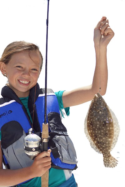 FishingFishing is fun for the whole family, book an offshore or bay fishing trip
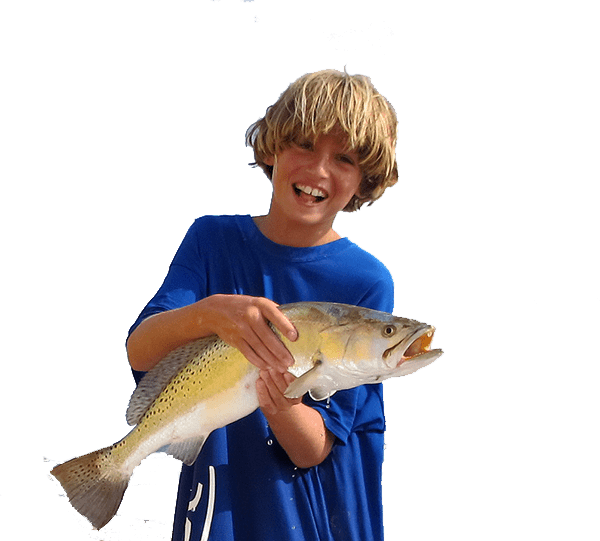 Fishing Guides